

O Brazil It is a country of continental dimensions, with an area of around 8.5 million km² and a wide range of latitudinal (North-South), which gives it a rich climatic diversity and, by extension, biological.
Not by chance, the Brazilian territory is recognized as one of the places with the widest biodiversity on the planet. Thus, in order to better understand and study the dynamics of these landscapes, the concept of morphoclimatic domains of Brazil.
see more
Inequality: IBGE discloses the 10 worst states to…
Israel is the 4th strongest military power in the world; check the ranking
The classification of the Brazilian territory into different morphoclimatic domains was elaborated by geographer Aziz Ab’Sáber (1924-2012), who quantifies the national space in six large environments natural:
In addition to these compositions, there are also transition areas, marked by morphological plurality from the intersection between two or more domains.

It is the largest among the Brazilian morphoclimatic domains, with an estimated area of approximately 5 million km².
covers the whole North region of the country, in addition to the North of Mato Grosso and west of Maranhao, standing out for the large volume of its forests, for its complex hydrographic network and for the great variability of its ecosystems. However, it is the domain over which human activities have expanded most in recent years, which represents a serious threat.
Although it has a wide area, the amazon domain it does not extend much in the latitudinal sense, being almost entirely positioned in a region close to the Equator Line. With this, the sunstroke is strong all year round and the air masses Actuators are hot and humid.
In this way, the presence of humidity – something that is also related to the evapotranspiration of the Amazon rainforest – causes the temperature variation (thermal amplitude) to be very low, with annual thermal averages of approximately 25ºC.

The soils, in general, have low fertility, which makes it difficult to occupy the forest for agriculture, with extensive livestock farming being the most common economic activity in the area of this domain.
The Amazonian Equatorial Forest is commonly classified according to the proximity of vegetation to water courses. It is thus divided into:
The nomenclature above indicates the composition of this domain, which covers the Cerrado biome, classified as a specific type among savannah formations.
It occupies an area of 2 million km² and is one of the environments most threatened by the advance of economic activities in its natural space.
O relief is predominantly made up of plateaus, where there is a large number of plateaus, such as dos Veadeiros (GO), diamond (BA) and Guimarães (MT).

This morphoclimatic domain has two very well defined climates throughout the year, one very dry and cold (but with a large temperature range throughout the day) and the other humid and hot.
In hydrographic terms, the region stands out for harboring springs and watercourses that supply some of the main rivers in the region. South America, involving the Tocantins-Araguaia basin and parts of San Francisco Basin It's from Paraná.
Although the cerrado soils have an acidic composition, especially the latosols (which are rich in iron and aluminum), the region has been, since the 1970s, quite occupied by agriculture, especially after the development of liming, a technique that corrects acidity by adding limestone to the ground.
Currently, only approximately 20% of the original area occupied by native Cerrado vegetation remains.
The dominion of the seas of morro – also known as Atlantic forest – is located in a vast latitudinal extension along the Brazilian coastal space, totaling about 650 thousand km², ranging from the large northern river until the Rio Grande do Sul.
The Atlantic Forest is the most devastated of the country's biomes, having been occupied since colonial times.

As in the Amazonian domain, the hill seas have a low temperature range due to the large presence of humidity, mainly in its southernmost region, with the presence of humid tropical, altitude tropical and subtropical climates damp.
This climatic configuration and the constant rainfall regimes, favored the formation of deep soils due to the action of the chemical weathering, many of them very productive, which facilitated the territorial occupation and the consequent logging.
The origin of the name “mares de morro” is due to its geomorphological features, with relief forms in convex appearance, in the so-called “mamelonar” style, as if they were small mounds in the shape of socks oranges.
The predominant landforms are the plateaus, in addition to some coastal depressions.
This domain involves the region occupied by the caatinga biome, which is the unique exclusively Brazilian vegetable composition, occupying an area of 850 thousand km².
It is a region called “Polígono das Secas” due to the harsh semi-arid climate. In this environment, temperatures have averages reaching 29ºC per year, with a low, irregular and poorly distributed rainfall regime throughout the year.

Due to the great climatic rigor, the predominant vegetation is of the type xerophile, those that adapt to the dry climate by retaining water, with wide roots, thick stalks and leaves that often consist of thorns. In rainy periods, this vegetation takes on a more voluminous appearance and transforms the landscape of the hinterland.
The relief of the region is marked by the great presence of relative depressions, surrounded by areas of plateaus, which helps to explain the aridity due to the dam of the air humidity by relief forms. In these environments, physical weathering prevails over chemical weathering, which makes them very shallow and stony.
Agriculture is more common in the so-called swamps, which are concentrated on the slopes of the mountains and plateaus, where rainfall is a little more common.
This domain, as the nomenclature already points out, covers the space occupied by Araucaria woods, occupying much of the South region in an area of 400 thousand km².
The local climate is humid subtropical, which is directly caused by the geographical position south of the Tropic of Capricorn, with average annual rainfall ranging from 1400mm to 2000mm.

The altitudes of the region vary between 800 and 1300 in an area of plateaus, with the presence of deep and very fertile soils, from of which stands out the "earth of purple" originated from the weathering of basaltic rocks produced in volcanic processes today extinct.
This same area covers most of the Paraná Basin and also the Uruguay Basin.
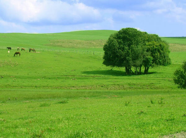
The morphoclimatic domain of the Grasslands – known as pampa gaucho – is located in the extreme south of Brazil as an extension of the fields and prairies located in the Argentina and in Uruguay.
The vegetation in these environments is predominantly composed of herbs, which are plants with stems not woody or flexible, never more than two meters.
The soils are geologically young and quite occupied by agriculture. In some areas, the sandy composition makes the removal of vegetation and the intensive use of the surface lead to a process called sanding, with the consequent formation of sandy areas, which are totally unproductive.
The predominant climate is subtropical, with average temperatures of approximately 16ºC, with occasional periods of prolonged drought.
See more: