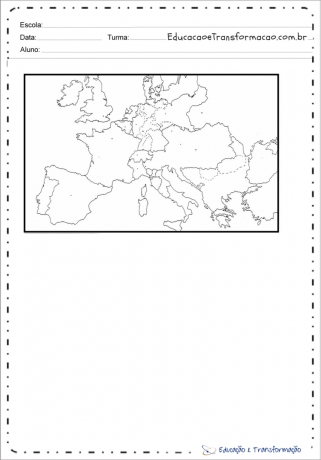
Get to know the Map of Europe, territorial data, number of countries and geographic information.
Europe is, by convention, one of the six continents in the world. Comprising the western peninsula of Eurasia, Europe is generally divided from Asia to the east by the watershed of the Ural Mountains, the Ural River, the Caspian Sea, the Caucasus, and the Black Sea to the southeast.
With an area of just over 10 million square kilometers, which corresponds to only 7% of the emerged land, Europe is one of the smallest continental portions of the globe.
The European continent: Extends from the Atlantic Ocean to the Ural Mountains (which separate it from Asia).
Unlike other continents, the lands of Europe are not tightly distributed.
The coast of the European continent is extensive and very jagged, contains a large number of seas, gulfs, peninsulas, fjords and other geographic features.
It facilitates the construction of ports, favoring the use of maritime transport.
To the north on the Aegean and Caspian grounds. of cold climates, parts of the Atlantic and Arctic freeze in winter, making navigation difficult.
Russia is one of the countries most affected by low temperatures on sea trips to the Atlantic. The only ones you can count on are frozen for part of the winter.
Index

Discover the countries and capitals that are part of Europe.
Another map:

Look at the 2006 political division map of Europe.

Relief and hydrography.

Source: Atlas 2000. La France et le monde. Paris: Nathan, 1998. P. 28 (adapted). Mario Yoshida

Source: La Géographie de Monde. Paris: Nathan, 2000. P. 13 (adapted).
The temperate oceanic climate, which occurs in the western part of the continent, is influenced by the Gulf Stream; it is humid, with less severe summer and winter. The temperature range in this region is smaller than in the interior of the continent, and the rains, which are abundant, are regularly distributed over the 12 months of the year, reaching greater amounts in winter.
The temperate continental climate occurs in the interior of the continent and is not influenced by the sea. It covers the central and eastern parts of Europe, where the summers are hot, in contrast to the winter, which is quite rigorous and with snowfall; thermal amplitude is large, and the rains, quite irregular, fall in greater quantity in summer and spring.

Source: Rémy Knafou. Histoire/Geographie ( initiation économique). Paris: Belin, 1992. P. 202 (adapted).

To color is a great way to work maps with students in the classroom or homework, here are some suggestions to print for free:


Subscribe to our email list and receive interesting information and updates in your email inbox
Thanks for signing up.