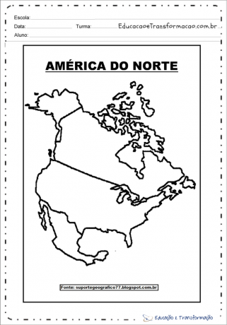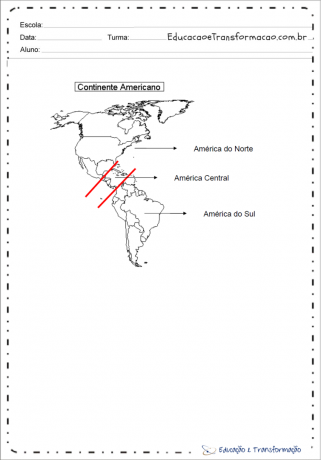
Meet in this post the America Map and geographic data for the continent.
America is the continent located in the western hemisphere and extends, in a north-south direction, from the Arctic Ocean to Cape Horn, along about 15 thousand kilometers.
America has a territorial extension: 42,189,120 km² and has 35 countries.
Oceans and Seas: Atlantic Ocean (East Coast); Pacific Ocean (west coast); Arctic Glacial Ocean (far north).
See too: Africa Map.
Index
We can regionalize the American continent into two regions:


Latin America: it is a region of America where languages derived from Latin are primarily spoken, particularly Spanish, Portuguese and, occasionally, French. Latin America comprises almost all of South and Central America on the continent.
Anglo-Saxon America: refers to countries on the American continent whose main language is English, and which also have historical, ethnic, linguistic and cultural ties with the United Kingdom.

Geographically, America is divided into two large portions: North America and South America, united by a narrow strip of land, called the isthmus or Central America.

The American continent is located among all the Earth's climatic zones: (polar, tropical and temperate), with the exception of the Antarctic polar zone.
The oceans that bathe the continent are: West is the Pacific Ocean, East is the Atlantic Ocean and to the North is the Arctic Glacial Ocean.

Research source: Prof. Luiz Fernando Wisniewski
Subscribe to our email list and receive interesting information and updates in your email inbox
Thanks for signing up.


